The Okanagan Basin Water Board (OBWB) has launched the “Okanagan Flood Story” website, which aims to help residents and local governments minimize flood risk.
“We’re very excited to see this launch, which happens to coincide with Emergency Preparedness Week,” said Anna Warwick Sears, executive director of OBWB. “Flooding is part of the Okanagan’s history, but we’ve long talked about the need for new flood maps, at the Water Board table and at local government tables as well. These maps are important to help residents, planners, developers, and others make the best decisions possible, ensuring we minimize our flood risk.”
The pressure for federal flood map funding began after the 2013 Calgary floods, explained Sears. Ottawa was getting its program in place when the Okanagan was hit with historic flooding in 2017. With funds then available, the OBWB worked with communities around the valley to apply for funding and coordinate mapping efforts.
“This website, at www.OkanaganFloodStory.ca, is the culmination of two years of flood mapping in our valley,” Sears added. “And it’s very clear that through state-of-the-art modelling that the potential for flooding is increasing with climate change. These maps are the first step in understanding and reducing our flood risk.”
In addition to the new flood maps, visitors to the website will find historical information on flooding in the Okanagan. The website also provides information that residents and local governments can use to reduce flood risk, prepare for and respond to floods, and recover from floods.
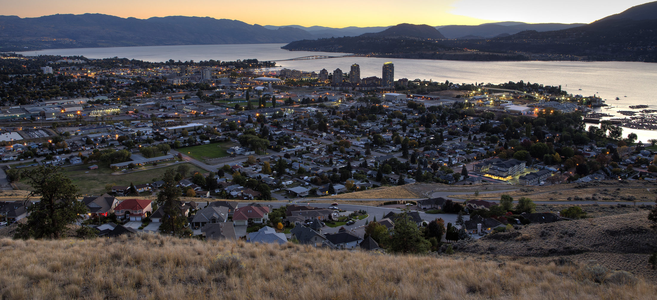
“It’s definitely something we all need to pay attention to, as local government and as residents—we need to address this together,” said Sue McKortoff, chair of OBWB and mayor of Osoyoos. “As we like to say at the OBWB, we are all part of ‘One valley. One water.’ What happens in one part of the valley, affects the next. And we all have a responsibility as Okanagan residents to build flood resilience.
“I know people like to live down on the water with the views, and be able to jump in their boats. But you know, there’s a reason why Osoyoos Indian Band didn’t build on the water. They knew what would happen,” McKortoff noted. “It’s too easy for people to be guided by their hearts and not their heads, until it’s too late. Having updated mapping, and concrete information that says ‘here are the best practices,’ will help residents make the right decisions, as well as local governments and even provincial and federal officials.”
The new maps can assist local governments determine where dikes, roads or bridges need to be reinforced, and where building codes need to be updated to reduce property damage, according to Sears.
“As the weather warms, as mountain snow melts, and as we head into the Okanagan’s freshet season, the roll-out of this project couldn’t be more timely,” said Sears. “We hope people will find the website and the information it contains useful.”
This project was made possible with $2.5 million in funding for LiDAR and flood mapping. LiDAR funding was provided by Emergency Management BC (EMBC). Flood mapping was funded by EMBC, Public Safety Canada under the National Disaster Mitigation Program, and from the Province of B.C. administered by the Union of B.C. Municipalities under the Community Emergency Preparedness Fund.
The project was managed by the Okanagan Basin Water Board (OBWB) and supported by the Regional Districts of North Okanagan, Central Okanagan and Okanagan-Similkameen, and the Government of B.C., and was undertaken by Northwest Hydraulic Consultants Ltd.
Numerous local and First Nations governments also supported the project: Okanagan Nation Alliance, City of Armstrong, Township of Spallumcheen, City of Vernon, District of Coldstream, District of Lake Country, City of Kelowna, City of West Kelowna, District of Peachland, District of Summerland, City of Penticton, Town of Oliver, Town of Osoyoos, Splatsin First Nation, Okanagan Indian Band, Westbank First Nation, Penticton Indian Band, and Osoyoos Indian Band.