


Equip emergency management with Hyperlocal rainfall data, NowCasts, alerts.
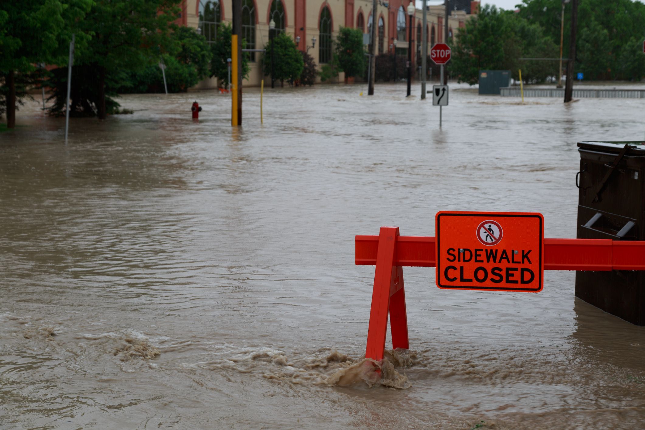
After wildfires are contained and extinguished, burn scars leave a heightened risk of flooding for at least two years until vegetation is reestablished. Without plants to hold soil in place, locations downhill and downstream from scorched areas are particularly susceptible to flash floods and debris flows.
As water flows downhill, the eroding landscape picks up sand, ash, vegetation and silt. The force of the debris flow can damage communities and infrastructure many miles downstream. Unlike water, a fast-moving mud flow can flow sideways, complicating flow path predictions and mitigation efforts. According to the (U.S.) National Weather Service, a good rule of thumb is ‘if you can look uphill from where you are and see a burnt-out area, you are at risk’ of debris flows.
Rainfall rate matters more than total rainfall
Depending on the intensity of the fire, impermeable or hydrophobic soil conditions can result and further elevate the levels of risk. Unhealthy soil conditions result in higher stormwater runoff rates, so much less rainfall is required to trigger a flash flood and debris flows.
The time required for a flash flood to begin depends on the severity of the fire and the steepness of the terrain, combined with the rate of precipitation. Areas of less severe burn damage and flatter terrain will be able to absorb more water.
Meteorologists emphasize that rate of rainfall is more critical than total amount of rainfall. Another rule of thumb is at least 0.5 inches (12.7 mm) of rain in less than an hour is sufficient to cause flash flooding in a burn scar. The National Weather Service cautions that the actual rate can be ‘more or less depending on the factors above’.
A debris flow can happen even on a dry slope after a few minutes of intense rain. If a fire-ravaged region is expecting moderate or heavy rainfall, the National Weather Service forewarns that flash floods and debris flows are possible even before a flash flood warning might be issued.
More accurate, more precise weather forecasts
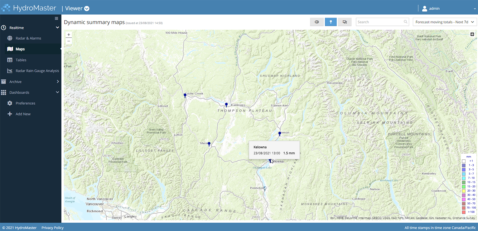
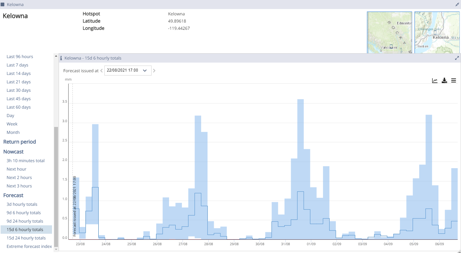
Flood risk managers and field teams can conveniently access hyperlocal radar rainfall observations in real time, three-hour projections known as NowCasts, and forecasts up to 15 days into the future. While the most accurate forecasts are projections of up to 3 days, the use of a multi-model ensemble increases confidence in longer-term forecasts.
Unlike publicly-available weather forecasts, commercial data services like HydroMaster are providing gridded data at 10-minute intervals and with a higher spatial resolution – as granular as one square kilometre.
Vahid Taleban, Water Resources Engineer, with Grand River Conservation Authority (GRCA) noted during a May, 2020 storm, “HydroMaster was consistently predicting much lower precipitation than public sources, which resulted in forecast flows sometimes an order of magnitude lower than what would have been generated had other precipitation forecasts been used. The end result? The forecasts were close to what actually happened — more accurate than forecasts based on all the other available precipitation sources. This justified GRCA’s much lower flood forecast numbers. The spatial resolution of the forecasts was excellent.”
Access, Alarms, and Coordinated Action
HydroMaster is available 24/7 as a secure hosted service. From a desktop or mobile device, a web browser enables every member of a flood control team to view and ground-truth satellite imagery with in-situ gauges across a watershed.
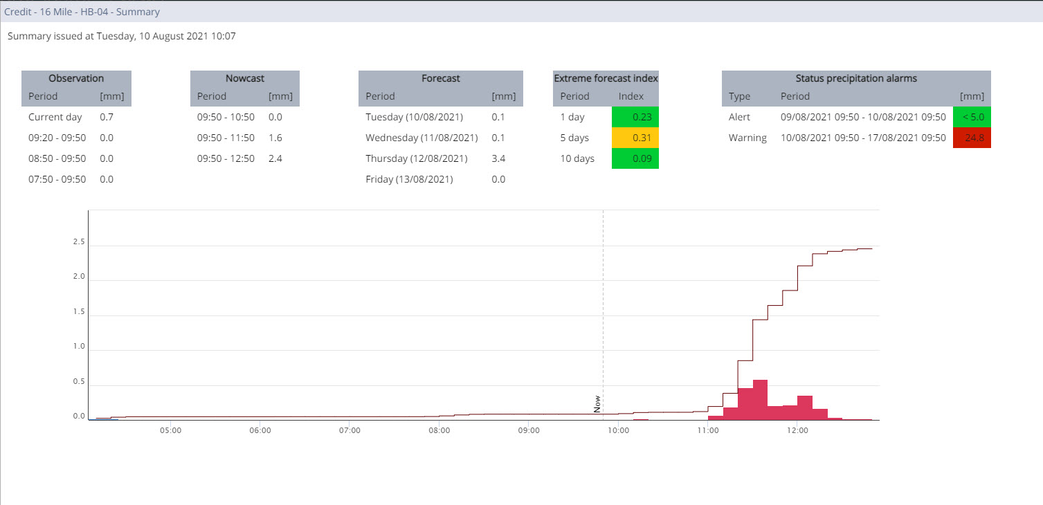
Context-rich maps, colour-coded tables, group and personal dashboards empower personnel on duty to quickly assess flooding risk and coordinate prevention of potential impacts on points of interest, a specific catchment, or a broader area. The Extreme Forecast Index monitors extreme weather conditions, producing severity index values for up to 10 days in advance. Alarm settings allow users to define their own thresholds on observations and forecasts.
The Archive feature allows users to capture all forecasts data, real-time observations, and other data sources in a permanent data store which can be used to better understand rare or extreme events – or to justify operational decisions.
‘Heavy or prolonged periods of rain or extreme cloud bursts can be predicted before the event. This allows mitigation of serious problems. Knowing up to 5 days in advance is a remarkable feature – to help authorities protect people and infrastructure,’ said Klaus Kisters, CEO of KISTERS AG.
This article was written by Steve Elgie, a Canadian consultant with KISTERS North America,
who specializes in KISTERS’ radar data services, hydropower optimization and operations solutions, water information platforms, and their integration with decision-support systems.


