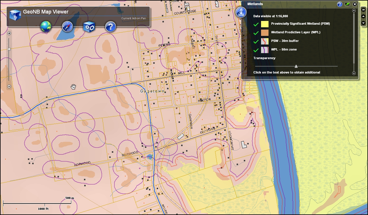

A new wetland predictive tool will soon be part of the GeoNB Map Viewer, New Brunswick’s free internet-based application for viewing maps and aerial photos of the province.
Available online through Service New Brunswick, the new application enables users to search GeoNB for wetlands or potential wetlands and analyze their proximity to other locations on the map, a function that may help real estate agents, land developers and potential buyers determine whether a prospective development is potentially within or close to a wetland or potential wetland.
The map was developed by the Department of Environment with data from the Department of Natural Resources and the University of New Brunswick. This map includes provincially significant wetlands and other areas that are likely to be wetlands due to the water table being close to the surface.
The Department of the Environment built the custom code for the wetland predictive tool in collaboration with Service New Brunswick. This is the second time that the Department of Environment has collaborated with Service New Brunswick to build a custom tool for GeoNB. In May 2010, the department and Service New Brunswick added the Flood Information tool to the GeoNB Map Viewer.
GeoNB is a collaborative project led by Service New Brunswick with participation from several provincial departments and municipal governments. Its popularity has consistently grown since its launch in November 2009 and is now receiving more than 6,000 visitors a week.


[…] This post was mentioned on Twitter by Canadian Water and SEAWA. SEAWA said: Very cool! GeoNB Adds Wetland Map Tool http://bit.ly/ehu3V0 via WaterCanada.net […]
[…] This post was mentioned on Twitter by Canadian Water and SEAWA. SEAWA said: Very cool! GeoNB Adds Wetland Map Tool http://bit.ly/ehu3V0 via WaterCanada.net […]