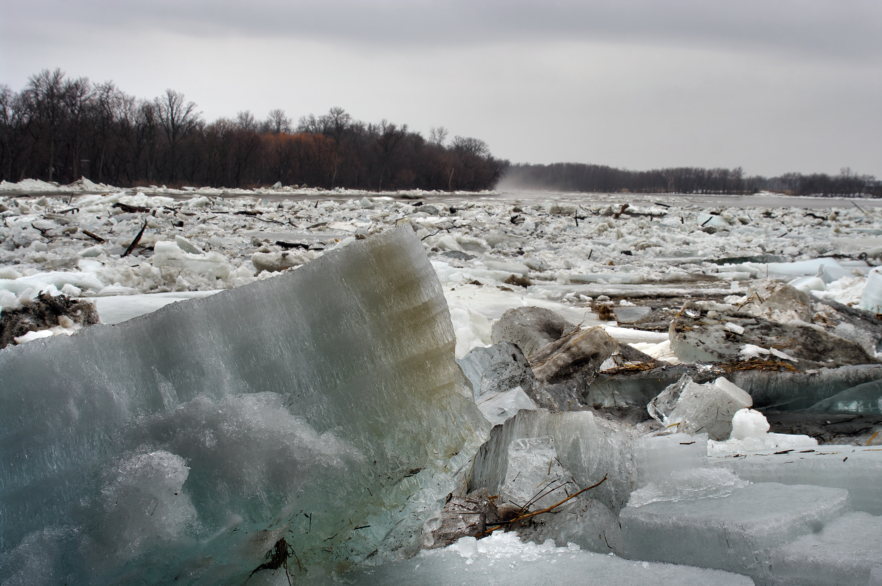
A University of Saskatchewan professor is working on better predicting ice formation in rivers, and potential ice jamming, to reduce the risk of flooding.
When we hear about a river flood, we might assume it was caused by a heavy downpour or warm spring temperatures that led to rapid snowmelt. Ice jams are, however, a significant contributor to flooding.
Much of Manitoba’s 2009 Red River flood—one of the five worst floods in Canadian history—was caused by an ice jam, which forced water to back up and flow over the banks of the river. The flood event damaged 250 homes and caused $38.5 million in direct financial losses. Severe ice jams were also a significant factor in the Red River floods of 2004 and 2007.
Better prediction of river ice and jamming potential would improve estimates of ice jam flood probabilities. These probabilities could feed into planning, infrastructure development, and flood mitigation programs—ultimately reducing flood risk. It would also help governments and water managers make more informed decisions on cost effectiveness and more strategically direct ice cutting operations and artificial ice cover breakup programs.
Karl-Erich Lindenschmidt, an associate professor at the University of Saskatchewan, is investigating river ice as part of a modelling project that is funded by the Canada First Research Excellence Fund. The project is engaging four Canadian universities, 12 government agencies, and more than 10 end-user communities.
“Predicting exactly when the ice will break up and cause flooding along a river is a sophisticated task due to the chaotic nature of ice jam formation caused by varying conditions and the distinct types of ice cover formed,” said Lindenschmidt.
Lindenschmidt has introduced a modelling method using the RIVICE platform to mimic chaotic ice-jam formation and predict the probability of jamming and potential flooding. The method has been applied to several river systems across Canada, including in a fully automated, real-time flood forecasting system of the Government of Newfoundland and Labrador for the Churchill River in Labrador.
Lindenschmidt sees this work as critical for managing waterways plagued by ice-jam flooding in Canada and around the world. He has published a book that includes a step-by-step guide for practitioners on using the modelling technique.