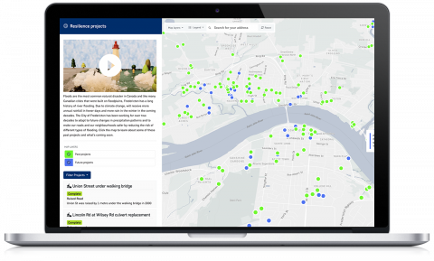
With $100,000 in financial support from Intact Public Entities (IPE) and Intact Financial Corporation, the City of Fredericton has launched an interactive Neighbourhood Flood Risk Map. This will allow residents to learn more about the current flood risk to their properties, actions they can take around their home and lot to reduce the risk, and capital projects by the City to make their neighbourhood more flood resilient.
Floods are the most common natural disaster in Canada. They can happen at any time of year, and in extreme cases they can damage homes and properties, and endanger the safety of residents. With climate change, we can expect increasing rainfall, including during the winter months when the frozen soil can’t absorb as much water. As our city grows, more paved surfaces will have a similar effect, allowing flood waters to spread further and faster.The funding from IPE and Intact Financial Corporation is provided as a Municipal Climate Resiliency Grant, and will allow residents to be more informed about the work the City has done to protect them, and how they can also better protect themselves against floods. To learn more about the new interactive Neighbourhood Flood Risk Map.


