Water resource conflicts are becoming increasingly prevalent as the intensity of competing uses of nearshore environments increases. Given the complexity of environmental systems, successfully managing and cost-effectively addressing these conflicts can be challenging. To address such challenges, a five-partner collaboration, comprising Golder Associates, Esri Canada, the Applied Geomatics Research Group, Scotia Weather Services and GeoNet, is developing and testing a water quality forecasting and infrastructure optimization system piloted in Nova Scotia’s Annapolis Basin.
Funded by the Atlantic Innovation Fund of the Atlantic Canada Opportunities Agency, the research project leverages geospatial technology for advanced mapping and analysis of various factors affecting water quality. When completed, the system will allow municipalities in the basin to focus their infrastructure investment strategies to maximize environmental returns and allow shellfish harvesting to be planned in a way that maximizes existing resources.
The issue
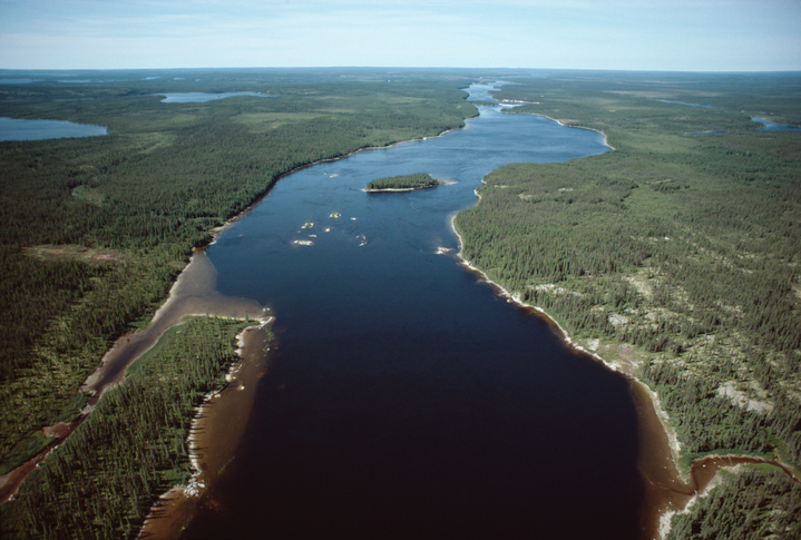
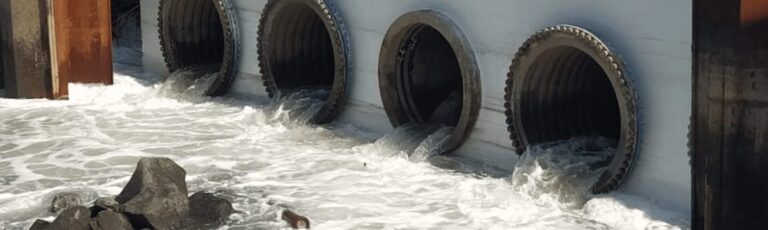
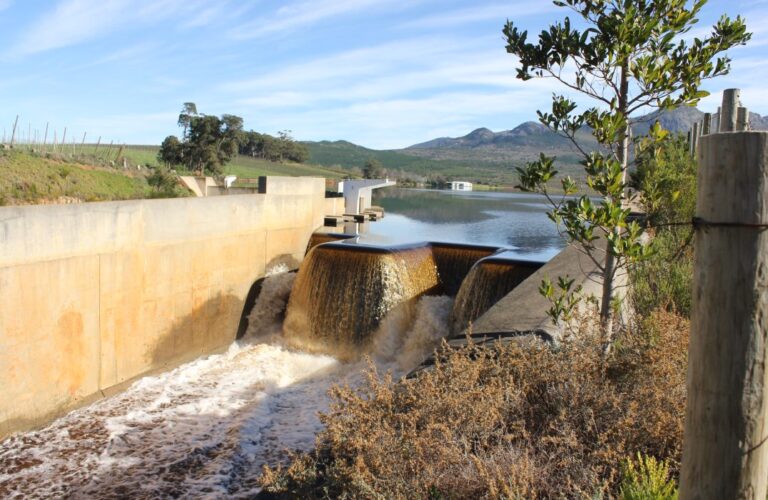
Shellfish harvesting is a key part of the economy of the Annapolis Basin, an arm of the Bay of Fundy in eastern Canada. For the region’s famed Digby clams and other seafood to be marketable, the water from which they are harvested must be sufficiently clean. This can be a challenge given the area’s proximity to sources of potential contamination, such as municipal wastewater treatment plants (WWTPs), watershed runoff, and concentrated deposits of fecal matter from seabirds and seals, as well as high tidal flows that can carry contaminants far from the source and render the harvest from some of the basin’s shellfish growing areas (SGAs) temporarily unsafe.

The regulatory framework and municipal conundrum
While current legislative controls in Canada, administered via the Canadian Shellfish Sanitation Program (CSSP), provide the necessary checks and balances for protecting human health, their application is relatively labour intensive and expensive. Understandably, the current protocols are geared to exercising precaution. This often leads to closures of growing areas, in cases where these have the potential to yield high-quality harvests under optimal environmental conditions. Conversely, where shellfish harvested from non-prohibited areas are identified as contaminated during the testing process, the harvest is inevitably worthless unless it can be purified cost-effectively.
Given the increasing pressures on shellfish populations, local municipalities are compelled to improve the quality of effluent from WWTPs. Often, the strategy is to direct finances towards upgrades at the largest or nearest WWTP discharge in the hope of realizing desired environmental returns.
There’s typically a limit to financial capital available to facilitate the desired improvements, and investments do not always yield proportionate environmental returns. The reason is that the significance of individual contaminant sources is not always readily attributed to proximity or the quantity or quality of the source, but rather to a combination of environmental carrying capacity, transport pathways, and the above factors. Municipalities retain a vested interest in protecting local water resources to maintain or increase revenues; however, their financial resources are limited and need to be invested wisely.
The proposed solution
A number of opportunities emerge in addressing these challenges; both from a regulatory and a municipal infrastructure investment perspective. The key to realizing these opportunities is the ability to correlate the magnitude and duration of water quality impacts with their causal contaminant sources. To make these correlations, it’s necessary to develop a comprehensive understanding of the underlying environmental components (contamination generation, attenuation, transportation and decay factors) that affect the magnitude and timing of contaminant inputs, as well as their movement between the sources and SGAs.
This approach revolves around identifying each bacteriological contaminant source (including diffuse sources) and receptor (in this case SGAs), and then isolating and defining parameters for the key determinants (components) that influence the association between the two.
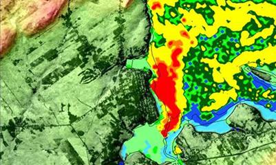
For the Annapolis Basin study, the research team created an inventory of bacterial contaminant sources within the estuary’s watershed drainage area–including, bacteriological point discharges (municipal and, if relevant, industrial facilities), buildings (not serviced by municipal treatment networks), land use classifications and areas known to include high-density bird populations. This data was generated and stored in a geographic information system (GIS). The system integrates various data layers and displays them on a map, allowing for effective visual analysis. Points of interest (POI) were selected throughout each shellfish growing area in the basin to provide spatial context for water quality forecasts at each receptor.
In this instance, the water quality forecasting and infrastructure optimization system studied four independent, but connected, components (loadings, meteorology, watershed hydrology, and estuarine hydrodynamics) used to characterize the associations between each source and POI through a large number of unique representative environmental scenarios.
Scenarios for each component were generated using calibrated and validated models to represent inherent characteristic variations across the following:
- an appropriate range of weather conditions (considering antecedent, current and future conditions);
- the range of potential loading conditions (based on loading rates generated from individual land parcels and at discharge locations considering source type, seasonality and antecedent conditions);
- a range of watershed run-off responses (considering differing runoff characterizations for each land parcel or combined discharge location); and
- a range of estuarine transport conditions to define the relationships between individual estuarine discharges and each POI, the tidal type and tidal state and modifying factors (e.g. temperature and UV).
Given the large number of potential scenario combinations per source-POI combination, real-time modelling was not considered feasible; thus requiring the development of pre-determined scenario databases for each component. To tie together the relevant scenarios associated with each forecasted weather event, an automated processing system was conceptualized by Golder Associates and developed by Esri Canada and the Applied Geomatics Research Group, with contributions from Scotia Weather Services and GeoNet.
The system evaluates antecedent and forecasted meteorological conditions generated at hourly intervals in order to generate water quality forecasts for each POI for the upcoming 72 hours. Water quality forecasts are uploaded to a dedicated GIS-enabled web platform every six hours that allows the forecasts to be visualized in a spatial and temporal context.
Outdated forecasts are stored off-line to provide the necessary means to generate water quality performance and source-specific contribution statistics that municipalities can use to inform infrastructure investment decisions. By knowing how much individual sources have historically contributed to non-compliance at each SGA and what level of infrastructure investments are required to remedy the problem, municipalities will be in a position to optimize environmental returns on their investments, rather than applying intuitive investment strategies (i.e., targeting the highest or nearest discharge) in the hope of achieving desired outcomes.
Greg Rose, M.Sc., is a water resources scientist with Golder Associates based in Mississauga, Ontario. He has been in the water resources field for 12 years, where his work involves a broad scale of water quality evaluations covering municipal, industrial and mine discharges to riverine, lacustrine and estuarine environments.
Tim Webster has a Ph.D. in earth sciences from Dalhousie University. He has taught remote sensing and GIS at the Centre of Geographic Sciences since 1991, while actively pursuing his research interests with the Applied Geomatics Research Group, Nova Scotia Community College since 2000.