It’s been 15 years since the Port Lands Flood Protection project officially began, with an Environmental Assessment (EA) to study how best to restore the natural mouth of the Don River. But that’s just a blip in the life of this 38-kilometre river. Going back as far as 7,000 years, this river was a gathering place for Indigenous peoples, and a source of food and water.
Waterfront Toronto’s role in this story officially started 2005 with the Don Mouth Naturalization and Port Lands Flood Protection EA. A joint study with Toronto and Region Conservation Authority (TRCA), the goal was to re-naturalize the river mouth and protect the Port Lands and surrounding neighbourhoods from flooding in the event of a regulatory storm—all within an urban context.
Flood protection was core to Waterfront Toronto’s mandate from the time it was created by three orders of government in 2001. The first phase of flood protection stemmed from an environmental assessment for the West Don Lands completed in 2005 in partnership with TRCA and City of Toronto.
By building a flood protection landform under Corktown Common and lengthening of the Metrolinx railway crossing over the Don River, Waterfront Toronto and its partners protected a large swath of downtown Toronto from riverine flooding, allowing a master planned community in West Don Lands to take shape.
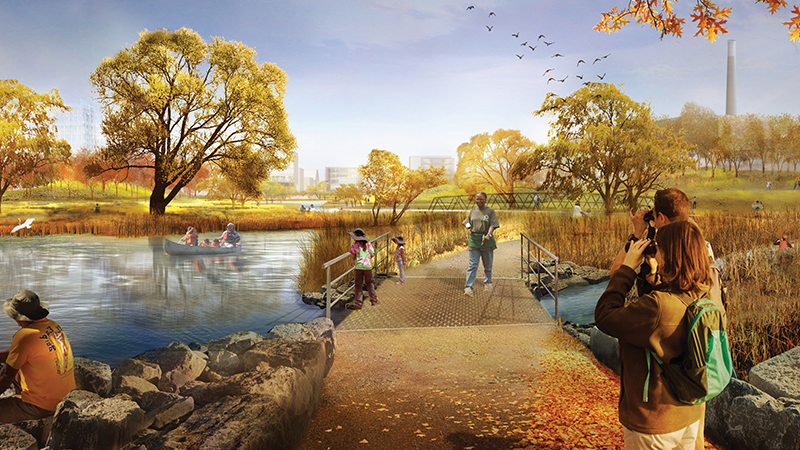
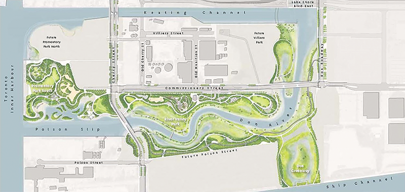
The next stage of flood protection was in the Port Lands, where flooding from the Don River puts approximately 290-hectares of land at risk. This represents nearly one third of the 800-hectare area Waterfront Toronto is tasked with revitalizing. Neighbourhoods like the Canary District in the West Don Lands are envisioned for the Port Lands once flood protection is complete in 2024.
How did we get here?
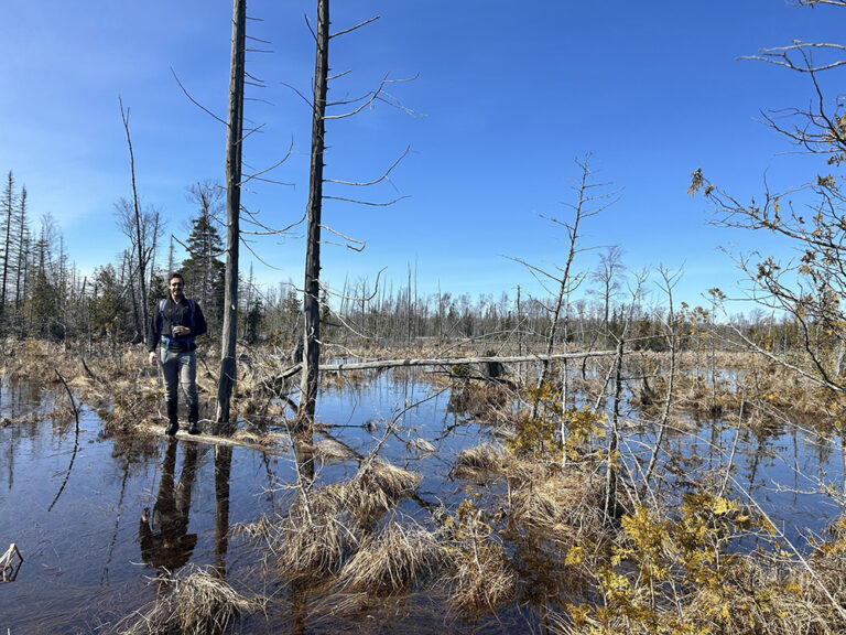
In 1912, the Board of the Toronto Harbour Commission completed a plan to transform Ashbridges Bay Marsh into a massive industrial district. By 1922, the marsh had been filled in to create more than 200-hectares of land, with another 200-hectares soon to follow. The Keating Channel was built along the northern edge of the former marsh in the late 1890s. The mouth of the Don River was redirected into the concrete lining of the Keating Channel, sending the river out into the inner harbour through a 90-degree turn. Over 100 years, the area was filled in to create what we now know as the Port Lands. This transformation from a large coastal wetland to a hard, channelized river and low-lying in-fill has left the Port Lands and surrounding area vulnerable to flooding from the Don River.
Starting in the 1950s, a second wave of development began. The Leslie Spit was built, as well as the Hearn Generating Station and the Commissioners Incinerator. The Gardiner Expressway was built in the 1950s over the mouth of the Don River. The opening of the St. Lawrence Seaway ignited a renewed effort to turn the Port Lands into a major shipping hub and industrial district. These aspirations never materialized and by the 1980s, the Port Lands remained underutilized but contaminated by a legacy of historical industrial activities. The area had become home primarily to civic and city-serving uses such as salt storage, as well as light industrial uses.
In 1989, a citizen-led task force began pushing for a re-naturalization of the Don River. The Task Force to Bring Back the Don sketched out the first vision of how the river could be revived. This recommendation from the Task Force was reinforced in 1992 with the release of Regeneration: Royal Commission on the Future of the Toronto Waterfront, which included recommendations for environmental enhancements and flood protection at the Don River mouth.
A 15-year timeline
In 2005, we began the process to establish the Terms of Reference process for the Don Mouth Naturalization and Port Lands Flood Protection Environmental Assessment (DMNP EA). This set the conditions of the EA.
In September 2006, the Ontario Ministry of Environment and Climate Change approved the terms of reference for the DMNP EA and the study formally began.
In 2007, Waterfront Toronto launched an international design competition to create a concept design that included habitat creation and flood protection fully integrated in a comprehensive plan for addressing urban design, transportation, naturalization, sustainability, and other ecological issues. This involved an extensive public consultation process and a week-long public exhibition. The winning design is by Michael Van Valkenburgh Associates. This provided the framework for what would become the preferred alternative through the DMNP EA.
In 2011, Toronto City Council adopted what would later be called the Port Lands Acceleration Initiative (PLAI). The goal of the initiative was to retain the core ideas behind the DMNP EA while developing strategies for accelerating revitalization in the Port Lands. This plan was refined in 2012 and became known as PLAI 2, which included the Port Lands Planning Framework, Villiers Island Precinct Plan and Port Lands, and South of Eastern Transportation and Servicing Master Plan Environmental Assessment.
In 2014, the Lower Don Lands Master Plan Environmental Assessment was approved. In 2015, the Don Mouth Naturalization and Port Lands Flood Protection Environmental Assessment was approved.
In May 2015, work began on the Due Diligence Report for Port Lands Flood Protection.
In October 2016, the Due Diligence Report for the Port Lands Flood Protection Project was completed, providing governments with additional assurance on the cost of this project, ways to mitigate the risks, and a strategy and schedule for executing the project. The first piece of work as part of Port Lands Flood Protection, Cherry Street Lakefilling, received tri-government funding in 2016 through the Clean Water and Wastewater Fund
In June 2017, $1.25 billion in municipal, provincial, and federal funding was awarded to the Port Lands Flood Protection Project.
In October 2017, the Port Lands Planning Framework and Villiers Island Precinct Plan were adopted by Toronto City Council.
Construction on the full Port Lands Flood Protection project began in December 2017. This ambitious undertaking is slated for completion in 2024. Cherry Street Lakefilling was completed in 2019. And with excavation on the river valley well underway and the first of four new bridges installed in the fall, this project is on track.
This article was written by Mira Shenker, the senior manager of communications and public engagement at Waterfront Toronto, for the January/February 2021 issue of Water Canada. The header image for this article was provided by Waterfront Toronto.