
Making a map is easy. Making a good resource inventory map is difficult. That’s what four southwest Saskatchewan rural municipalities (RMs) found out when they decided to create an inventory of groundwater resources in their region.
It requires a lot of data from different levels of government, resource agencies and teamwork, but once the inventory is completed, maps can open doors to economic opportunities and a better understanding of our precious water resources.
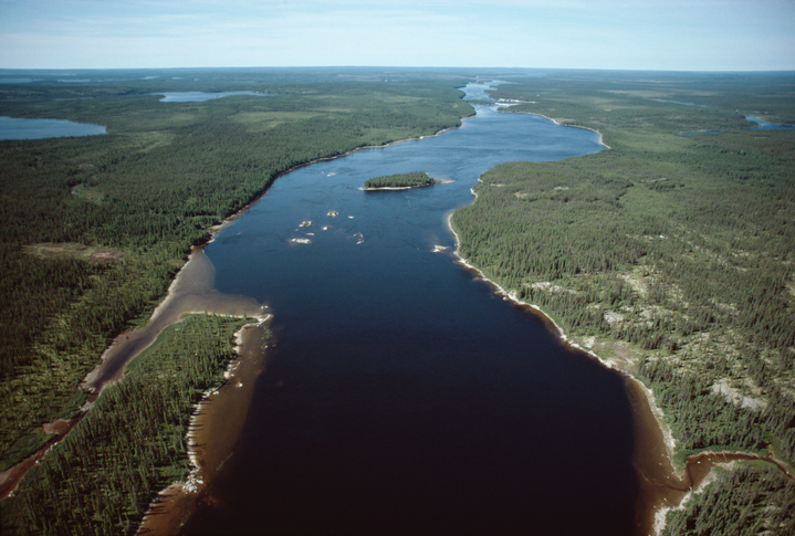
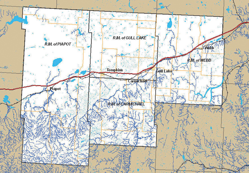
In early 2005, the Gull Lake Regional Water and Development Committee, with assistance from Agriculture and Agri-Food Canada (AAFC), started to create an inventory of local groundwater resources. Initially, the inventory took into account the location, quality and, where known, quantity of the region’s water sources. Primarily intended to attract economic development opportunities by having up-to-date data, the inventory also identified shallow aquifers that could be vulnerable to contamination.

The process started with the testing of approximately 500 wells in the four RMs (Carmichael, Piapot, Webb and Gull Lake), and was carried out with the technical and financial support of the Saskatchewan Watershed Authority which also compiled and reported the data.
The mapping for this project was done using Geographic Information System (GIS) technology.
AAFC’s GIS staff analyzed the data and converted it into a unified, readable product that the rural municipalities have found very useful.
AAFC GIS staff overlaid layer after layer of map information, often combining data from many sources. They assembled base layers, overlaid them with water bodies, and laid down RM boundary lines, topography and transportation routes.
 download muppets from space movie
 “We combined a variety of resources into this tool, like aerial photography, land cover and elevation, water bodies of different kinds from many different sources, and location of oil and natural gas wells from still more sources,” says Blaine Schafer, a GIS specialist with AAFC.
“This mapping tool allows you to turn on and turn off different layers of data as you go, depending on what you want to see,” he says. “In the blink of an eye, you can remove or add the layers of data you want to see.”
This was a job that no one government agency could do effectively as a lot of data came from multiple sources. And the data from each different source had their own limitations. For example, the aquifer maps had to be modified when inaccuracies were discovered.
Nevertheless, the end product was a GIS product that would be easy to use so the RMs can make better decisions regarding the natural resources in the area.

“We’re excited about this new tool,” says project manager Ida-Mae Leek. “We will be able to keep track of and be more evaluative of our resources in the region. And that helps us better protect the environment.”
“Without buy-in and commitment from the RMs and neighbouring towns, this mapping project would not have happened,” explains Brian Champion, AAFC manager involved in coordinating planning activities for resource and rural development. “The RMs wanted maps and better information to help focus their development efforts. They knew what questions needed to be asked and how answers could be used.”
The RM of Gull Lake was even awarded the 2007 Saskatchewan Municipal Award for Regional Leadership and Partnerships, for its role in bringing these rural municipalities together in a cooperative effort to build community and economic development for the area.
During the course of the project, a large number of abandoned wells were discovered in the area, which posed an environmental risk. Through AAFC’s Agri-Environmental Group Planning (AEGP) process, the RM identified and implemented beneficial management practices for decommissioning these wells and protecting the water quality of groundwater sources.
Close to 100 wells were properly decommissioned. Most of the wells being decommissioned were 30 inches in diameter and located in sandy soils, allowing for easy movement of water and any contaminants. The process to decommission a well is not expensive-typically costing $250 to $500 including materials, a tractor and labour.
In addition to well decommissioning, about 30 wintering site management projects are helping protect the area’s groundwater. These projects typically consist of fencing and remote watering systems designed to keep cattle out of the yard site and away from surface water and wells. Portable windbreaks keep the cattle out in the pasture longer and provide better manure distribution. Taken together, these projects represent a significant effort by area farmers to protect local water sources.
The entire community is benefiting from the protection against groundwater contamination-and the benefits don’t stop there. More producers are completing their own environmental farm plan and there is increased awareness of the value of identifying environmental risks and benefits, and establishing plans to implement beneficial management practices.
Priya Montgomery is with Agriculture and Agri-Food Canada.