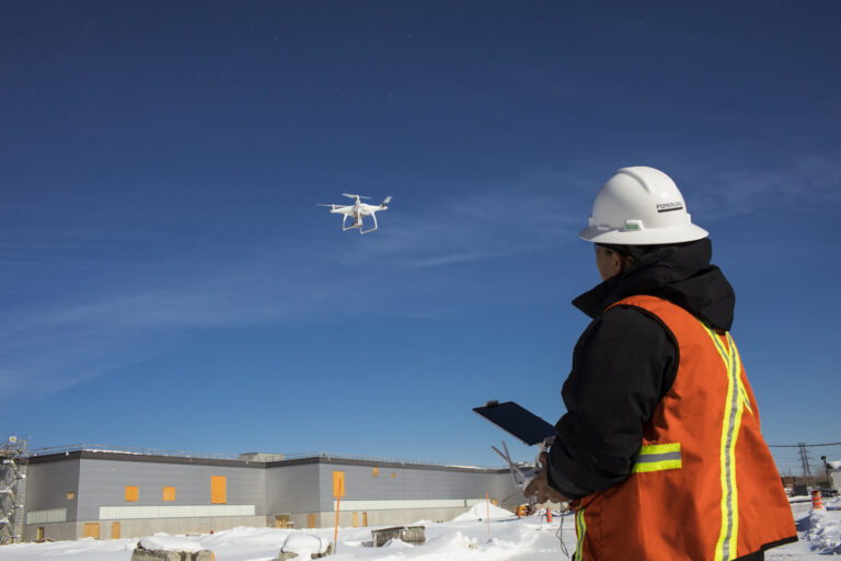
Radar data, NowCast, alert thresholds mobilize local knowledge of flood risk.
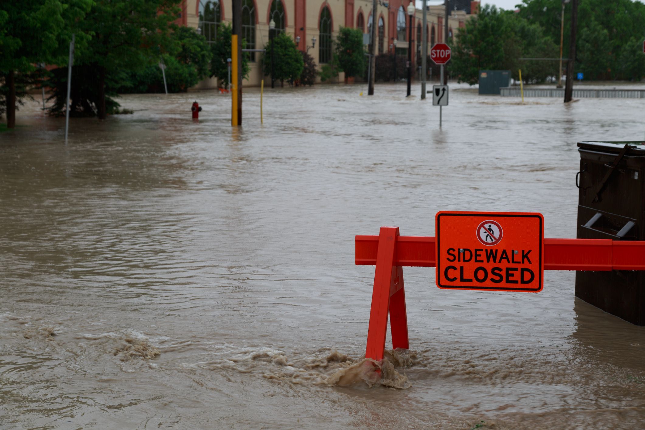
Climate extremes are manifesting as more frequent, often bigger rainstorms over Ontario. Combined with accelerated rates of snowmelt, extreme weather makes springtime flooding more unpredictable and severe. Dam operators and flood management agencies are adopting digital innovations to overcome unforeseen weather events and their impacts.
Flood forecasting systems are hardly new, but two critical components of them are getting a big boost: monitoring of weather forecasts and warnings in addition to data processing and information management.
Radar services enhance real time monitoring
Ensemble weather forecasts are conventionally used, but they have missed events including the 23 June 2017 storm. Over three to four hours, 126 mm became the highest daily total rainfall on record since 1950. In contrast, commercial data services like HydroMaster are using radar observations with a 10-minute time interval and a spatial resolution as small as one square kilometer. Model output statistic forecast products and hyperlocal information are informing features like NowCasts, or three-hour projections into the future, and multi-threshold alerts.
“Better awareness of unpredicted storms and antecedent conditions is a game changer,” remarked Johan Jaques, a career meteorologist and the solution owner of HydroMaster.
“Working closely with water companies, energy utilities, and network operators allows KISTERS to directly address needs and frustrations identified by today’s water professionals who require innovative decision support tools.” The cloud service also delivers deterministic forecasts up to 9 days and probabilistic forecasts up to 15 days into the future to support weather forecast-informed operations.
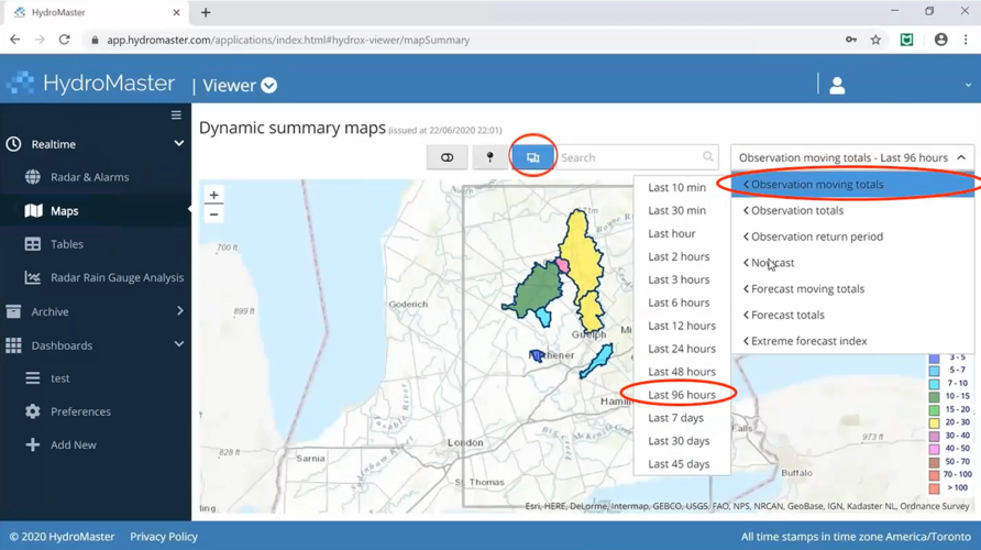
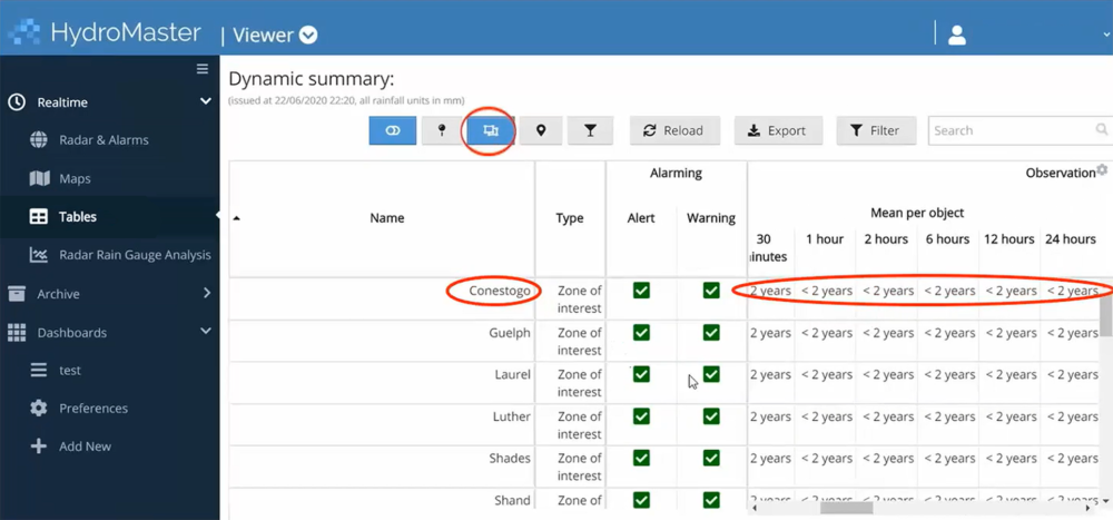
Not only is information from radar and ground-based rain gauges consolidated into a single intuitive web browser, but also the rarity or recurrence intervals of the rainfall event is reported in real-time. Map and personal dashboard visualization options empower staff on duty to more quickly assess risk of flooding and potential impacts on a specific catchment as well as areas or points of interest like dams.
Knowledge transfer retains organizational knowledge
Real-time utilisation of HydroMaster radar forecasts and nowcasts are an important part of the picture, but there are additional elements to consider. New availability to historical radar observations, when combined with in-situ monitoring network information and local knowledge of milestone events, enhances post event analyses and calibrates existing hydrologic models.
Grand River Conservation Authority (GRCA) is anticipating receipt of radar observations dating back to 2013 to further review significant flood events in its watershed. New insights will mobilize staff to update existing models and consequently, inform flood mapping. As the agency continues to improve its non-structural approaches to flood management, GRCA is using an Application Programming Interface (API) to feed better input into flood forecasting processes to recover more time to foresee and manage risks, especially those associated with its seven dams, three of which generate hydropower.
Contemplating the 23 June 2017 event over Luther Dam, Dwight Boyd, Director of Engineering at GRCA, remarked that the “NowCast feature would have bought three hours of warning time, time that would have been very useful” to assess risk, options, and make proactive decisions. Instead, staff were on emergency response mode because the rainfall event was unforeseen.
Personal application builds expertise
Not to let a dam failure occur in vain, Boyd and colleague Vahid Taleban, Water Resources Engineer, used HydroMaster to analyse the 17-19 May 2020 event over within the Tittabawassee subwatershed, in the U.S. about 350 km west of their location. Trying to understand conditions that caused the Michigan dam failures and better understand vulnerabilities of GRCA assets, they chose data from three (U.S.) National Oceanic and Atmospheric Administration (NOAA) radar stations and rain gauges in the vicinity and then superimposed the hourly conditions over the Grand River watershed.
Without more intimate knowledge of the 15-17 May 2020 Michigan storm event, Boyd pointed out that heavy rainfall forecasts were foreseen and warnings issued. After extrapolating and simulating the flood response over the northern parts of the Grand River watershed, inflows into the authority’s two largest dams and associated recurrence intervals revealed a five-year flow range. The events had similar rainfall totals, but rain fell over Grand River in four hours versus 24 hours over Michigan. The GRCA flood control team recognized the May, 2020 event would have been fairly easily managed without results of flooding or dam failure.
GRCA’s comprehensive flood management also includes structural approaches – dams, dykes, and channel works to convey water away from people. Boyd could not sufficiently emphasize the importance of regular maintenance, dam safety inspections, and addressing any design deficiencies. Guidance from the Provincial government and special advisory reports are beneficial and extensive.
Lessons can be learned from every flood event and dam failure and new IT innovations lessen uncertainty overall, but knowledge that becomes available has to be transferred by people and applied by organizations.
This article was written by Steve Elgie, a Canadian consultant with KISTERS North America, who specializes in KISTERS’ radar data services, hydropower generating optimization and dam safety solutions, water information platforms, and their integration with decision support systems.