Geologists may have uncovered why the Green River in the United States has carved a route through a mountainous area.
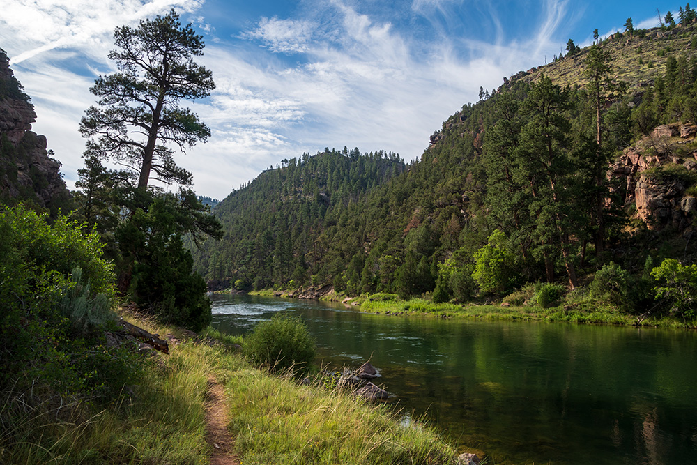
The Green River is the largest tributary of the Colorado River and goes through a 700-metre deep canyon through Utah’s 4km-high Uinta Mountains instead of flowing around them.
Researchers from both the UK and the US point to evidence of a phenomenon called ‘lithospheric dripping’, which causes mountains to subside and rebound over millions of years, as likely to be the cause of the Green River’s unusual route.
“For about 150 years now, geologists have debated over exactly how the rivers merged, which is a particularly challenging question for a tectonically inactive area where major geological events are rarer. We think that we’ve gathered enough evidence to show that lithospheric drip, which is still a relatively new concept in geology, is responsible for pulling the land down enough to enable the rivers to link and merge,” University of Glasgow School of Geographical & Earth Sciences professor Dr. Adam Smith said.
In order to cut its path through the Unita Mountains, the Green River ran over land that was temporarily lowered when a lithospheric drip developed beneath the mountains several million years ago, a University of Glasgow release said.
During that time, the river eroded the mountain rock and established the channel it flows through today, including the Canyon of Lodore which eventually linked it to the Colorado River.
Lithospheric drips occur when dense, mineral‑rich material forms at the base of the crust, eventually becoming heavy enough to sink into the mantle below. As they sink, they can drag down the land above them, pulling parts of mountain ranges downward, the release said.
“When the drip breaks off and continues to sink on its own, the mountain range rebounds, leaving behind a distinctive ‘bullseye’‑patterned zone of uplift across the landscape above the drip’s point of origin,” it added.
A paper published in the Journal of Geophysical Research: Earth Surface, demonstrated how the team used a combination of seismic imaging and sophisticated data modelling to reach their conclusion.
“This is a long paper, because we wanted not just to lay out the case for a lithospheric drip creating the route of the Green River but also to acknowledge some previous theories. The evidence we’ve collected strongly contradicts the idea that the river predated the mountains, or that sediment deposits might have built up enough for the river to overtop the range, or that erosion from the south of the mountains captured the Green River,” Smith said.