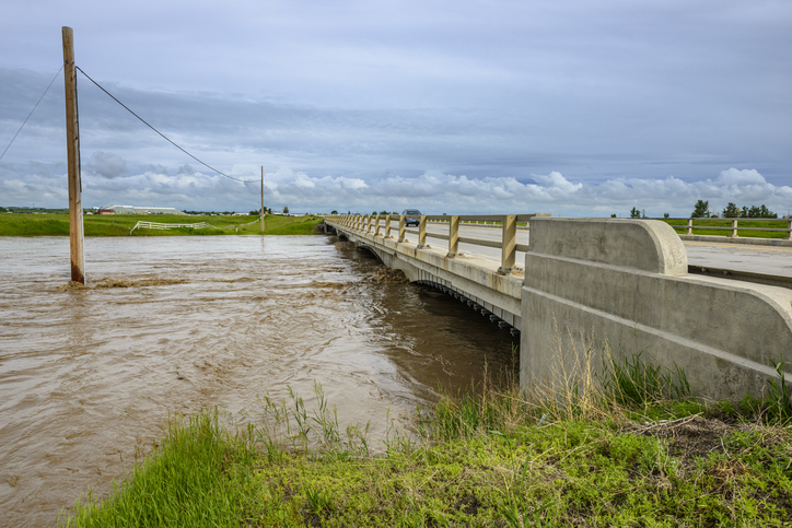
Flood maps play a critical role in helping Alberta’s communities prepare for flooding and respond more effectively when it happens by guiding land-use planning, supporting emergency preparedness, and protecting people, property and infrastructure.
Alberta’s government has released new Bow and Elbow River flood maps showing that Calgary’s flood risk along the Elbow River has been drastically reduced thanks to the recently completed Springbank Off-Stream Reservoir and other projects. More projects are already underway to keep strengthening flood protections in the city.
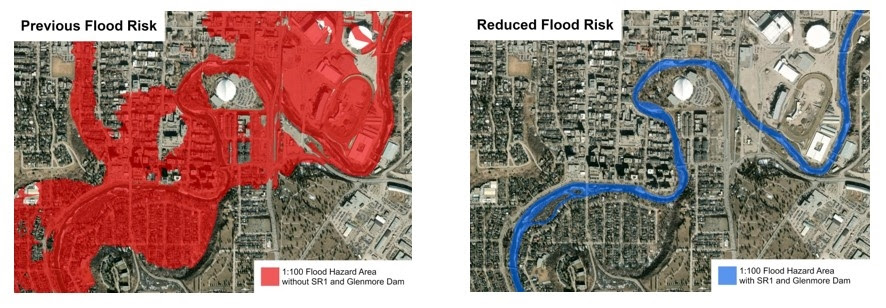
Image credit: Government of Alberta

“We committed to protect Calgary and other communities from floods and we are seeing the results. These new flood maps are good news for families and businesses, but we are also going to keep investing in reservoirs, berms, updated flood maps and the critical infrastructure needed to keep people and their property safe,” said Rebecca Schulz, Minister of Environment and Protected Areas.
Knowing where the water will flow during a flood is critical to understanding where it is safe to farm, safe to build, and how to best prepare for emergency situations. These maps will help the City of Calgary design and build for the future.
“The new Bow and Elbow River flood maps are very important for Calgary. Since 2013, understanding of our rivers has grown and a range of resilience measures have been put in place, which substantially lowers risk in many of our communities. It’s critical, while facing housing and affordability concerns, that the best, up-to-date flood hazard information is available, so we can keep building an informed, flood-resilient Calgary. We gratefully acknowledge the expertise and collaboration of the province in the updated river modelling and mapping,” said Frank Frigo, manager, environmental management, climate and environment, The City of Calgary.
While flood risks will vary at any given location, the newly released maps show significant decreases in major flood risks in many areas of Calgary. That is because, in the future, if water in the Elbow River rises to dangerous levels, the flow will be diverted into the Springbank Off-stream Reservoir and further reduced by the Glenmore Dam. This not only reduces the risk of flooding along the Elbow River in Calgary and other downstream communities, it also helps prevent future disasters like the devastating 2013 flood.
Alberta’s government has finalized more flood maps in the past five years than in the previous thirty-five years combined, with many more studies now underway. The relocated Ghost Dam project continues to advance on the Bow River, and the province has launched the five-year $125-million Drought and Flood Protection Program to help protect families, businesses and communities across the province.